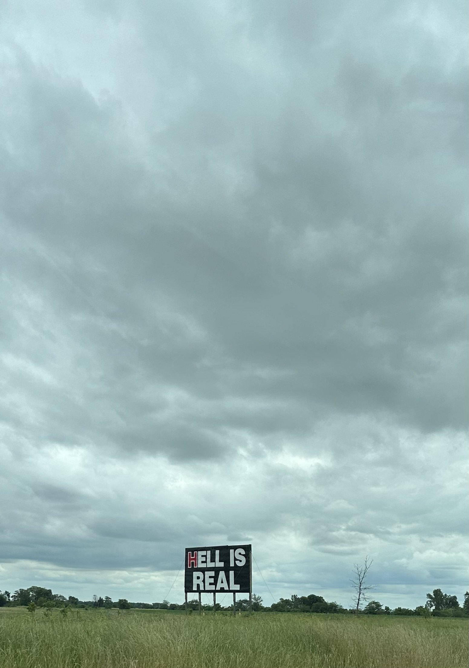
1
149
submitted 1 year ago* (last edited 1 year ago) by Theprogressivist@lemmy.world to c/pics@lemmy.world
2
1

Easy, 2.33 mi loop

180 ft elevation gain

Hiked 3/26/24

Flickr Album

An easy loop takes you to Barker dam, a small reservoir built for ranching in the early 1900s. This area is used extensively by climbers as many large outcrops may be found in the area. Apparently petroglyphs may also be found on a rock wall here, although I was unaware at the time so did not see.

A Joshua tree takes up the left half of the frame while in the distant right a large rock mound may be seen with a climber on the top of it attached to a climbing rope.

A large outcrop of fragmented rock rises up behind a field of small Joshua Trees under a blue sky dotted with a couple small clouds.

A massive rock mound with many small boulders eroding off of it stands above a small grouping of Joshua Trees. Several small clusters of trees may be seen growing in portions of the mound.

3
1
Great Mug (lemmy.ca)

cross-posted from: https://lemmy.ca/post/58356699

4
1
Shopdog, the Sequel (lemmy.world)
5
1
6
1

cross-posted from: https://piefed.social/c/shermanposting/p/1626407/regardless-of-what-side-of-the-cold-war-we-landed-on-we-all-stan-the-great-emancipator

Regardless of what side of the Cold War we landed on, we all stan the Great Emancipator o7

7
1
submitted 1 day ago by Sunny@slrpnk.net to c/pics@lemmy.world

Minus 15 degrees celsius 🫶

8
1
submitted 1 day ago by kunegis@feddit.org to c/pics@lemmy.world
9
1
submitted 2 days ago* (last edited 1 day ago) by setsneedtofeed@lemmy.world to c/pics@lemmy.world

Description: These two combatants are engaged in a foot tournament that was popular beginning in the 16th century. The object was to cut a dashing figure while breaking blunted pikes or swords over the opponent's helmet and left shoulder. The brow above the visor was the main target, explaining the damage visible on the helmet of the figure on the right, about to receive a blow. Points were awarded for each hit. The barrier protected against illegal strikes below the waist, making armor over the legs unnecessary.

The spectacle of these tournaments could be as extravagant as any joust. Performed both indoors and out, the entrance march of the combutants could be well choreographed with speeches, cantatas, parade floats, pyrotechnic displays, beating druns, and blearing horns. Early opera has its roots in this theatrical sport.

10
1
11
1

Moderate, 6.81 mi loop

1,316 ft elevation gain

Hiked 3/25/24

Flickr Album

At a higher elevation (~4,000ft) than many other sections of the park, this loop offers great views of Joshua Tree as well as a richer selection of flora. While popular, it seems to get a little less pressure than other parts of the park. Would likely be great for Sunrise or sunset viewing.

A small cluster of Joshua Trees.

A large Cholla Cactus sits on the edge of the trail, its many needled arms reaching out for hugs.

Several ridges of nearby hills lead away while in the far distance a snow dusted mountain may be seen being overtaken by clouds rolling over its peak. On the valley floor a collection of windmills may be seen as well.

12
1
submitted 2 days ago by Quilotoa@lemmy.ca to c/pics@lemmy.world

The bark is stripped off and used as cork.

13
1
submitted 2 days ago by jxk@sh.itjust.works to c/pics@lemmy.world
14
1

Hard, 9.24 out and back

2,621 ft elevation gain

Hiked 3/21/24

Flickr Album

Rising over 5,000 ft above the valley floor, the trail along Dante's Ridge offers endless breathtaking views of Death Valley. The trail begins at Dante's view and continues alongside Badwater Basin from above, with many ups and downs along the way. Full sun exposure so be prepared and hike early.

A male and female Common side-blotched lizard seen in the middle of reproducing. The female is giving me the 'skink eye.'

The steep ascent along the ridge leading to one of the upper areas of the hike. Scattered sagebrush may be seen dotting the tan landscape.

The disappearing Lake Manly may be seen down in the valley floor from this overlook, returning to a salt flat. On the other side of Death Valley a ridge runs across, with a layer of snow on the upper reaches.

15
1
submitted 3 days ago* (last edited 3 days ago) by Quilotoa@lemmy.ca to c/pics@lemmy.world
16
1

I've never seen her so dirty. It's good tho! It means she's feeling good enough to roll around like a dingus!

17
1

Moderate, 6.5 mi loop w spurs

1,207 ft elevation gain

Hiked 3/20/24

Flickr Album

A highly popular loop taking you along a gravel wash in lower sections before passing under the vertical face of Manly Beacon after taking a slight detour to the Red Cathedral geologic formation. Views of varying colored cliff faces and hillsides will mesmerize and the trek is filled with delights. This is still in that period where a decent amount of photos were lost, so I don't have better pictures of the Red Cathedral from up close unfortunately.

The Red Cathedral stands above a canyon of tan mounds. Various trails branching out from closer to the Cathedral allow you to access the mounds.

Two large rocky hillsides with layers of diagonal light and dark brown banding may be seen with a ridgeline in the distance on the other side of Death Valley.

Rolling hills of light and dark brown patterned rock may be seen with a sloped ridgeline on the right of frame. A separate ridgeline on the far end of Death Valley may be sen in the distance.

What looked like a fungus growing along a rock, which wouldn't really make much sense in a desert setting like this. I would assume it is connected to the plant seen on both sides of frame, and would possibly be for seed dispersal, but I am not sure what the plant is. There wasn't enough exposed plant material for me to get an id on it either, so it's a mystery to me.

18
1
submitted 4 days ago by Quilotoa@lemmy.ca to c/pics@lemmy.world

It was the third largest amphitheater in the empire, holding 25000. Game of Thrones did some filming in the city.

19
1

I keep crying because I'm so happy.

20
1
submitted 5 days ago by hexual@lemmy.world to c/pics@lemmy.world

Coledale, Lake District, England, UK.

21
1

cross-posted from: https://lemmy.world/post/24675555

Today is my best friends birthday. He would have been 50. Sadly he died on the 7th of this month.

Here one with him with my son who will turn 21 in March. He was always a good uncle to my kids.

This was the last time we saw him in person. He had been living in a nursing home for last three years. With him is my middle son.

Though we couldn't visit often (we live so far away) I spoke on the phone with him almost everyday.

I will miss him, he was best friend a guy could ask for. Won't ever have other like him.

22
1

Nature Walk

No elevation gain- located at 282 ft below sea level

Hiked 3/19/24

Flickr Album

During my trip to Death Valley in 2024, I was lucky enough to see Lake Manly, which was the first time it held water in 40 years. Badwater Basin is the lowest point in N. America, at -282 ft. Wading in the shallow water was like walking through an Epsom salt bath and was a once in a lifetime experience.

Looking up towards the sign post which shows where sea level is, 282 ft above my location on a cliff wall.

A pile of salts that has precipitated when the water was a little higher. I lost the photos of it, but when underwater it had a little more structure to it, with a lot of nodules linked together.

A view across Lake Manly near sunset. The sky at this point was still mainly blue leading to a little yellow and then a salmon pink in the lowest horizon. A ridgeline may be seen extending on the far side of the lake through the center of frame. One thing to note is that the ridgeline seen would be barely above sea level, so only high in relation to my location at -282 ft.

23
1
submitted 5 days ago by Quilotoa@lemmy.ca to c/pics@lemmy.world
24
1

Moderate to Strenuous, 4.4 mi loop w spur down

1,319 ft elevation gain

Hiked 3/19/24

Flickr Album

Journey around and into a maar (explosion pit) volcano which formed ~2,100 years ago. The rim hike will also take you to Little Hebe, a smaller and more well defined perfect circle crater. The return from the crater bottom, if hiked, is steep and gravel footing will test your legs, but so worth it.

Looking down into Ubehebe Crater, with a sign showing a person falling that warns to be careful around the edge as the footing may be dangerous.

A photo of a flowering Desert Fivespot, Eremalche rotundfolia that was growing on the rim of the Ubehebe Crater. With the wildflower not fully opened, it has a ball-like appearance in this photo. Flower is pink with five different red streaks on the interior (two seen in photo).

Looking over towards the Little Hebe Crater, which is located right beside Ubehebe Crater. In the distance, a mountain ridge may be seen with slight snow caps on a couple of peaks.

25
1
submitted 6 days ago* (last edited 6 days ago) by Wara@lemmy.world to c/pics@lemmy.world

I still can't believe he got away with this. The US is truly fucked.

view more: next ›

pics

26155 readers
285 users here now

Rules:

1.. Please mark original photos with [OC] in the title if you're the photographer

2..Pictures containing a politician from any country or planet are prohibited, this is a community voted on rule.

3.. Image must be a photograph, no AI or digital art.

4.. No NSFW/Cosplay/Spam/Trolling images.

5.. Be civil. No racism or bigotry.

Photo of the Week Rule(s):

1.. On Fridays, the most upvoted original, marked [OC], photo posted between Friday and Thursday will be the next week's banner and featured photo.

2.. The weekly photos will be saved for an end of the year run off.

Weeks 2023

Instance-wide rules always apply. https://mastodon.world/about

founded 2 years ago
MODERATORS