214
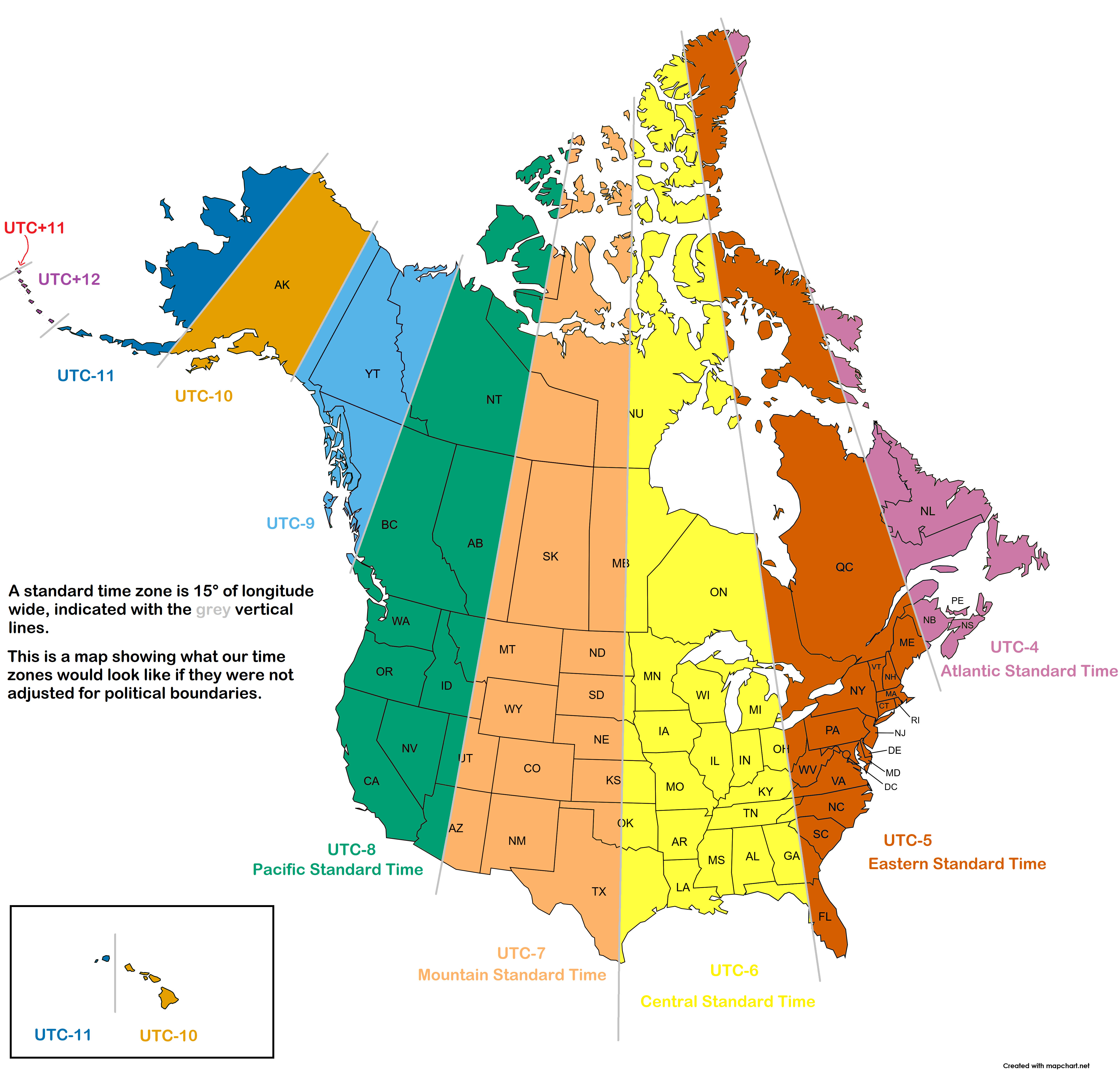
US/Canada time zones if they were not adjusted for political boundaries
(files.catbox.moe)
For the map enthused!
Rules:
post relevant content: interesting, informative, and/or pretty maps
be nice
Time zones are aligned to population centers as much as they are political boundaries.
For example, this methodology would probably cut major US cities in half. It's hard to tell exactly, but some cities would be Phoenix, the whole metropolitan corridor of Oklahoma City to San Antonio, Salt Lake City, and Detroit. In Canada, Edmonton and Calgary stand out.