60
A Proclamation on Loyalty Day, 2024 | The White House
(www.whitehouse.gov)
Depending on where the app detects you are, google maps shows different borders and names. So to some countries, it'll show "Gulf of America", "Gulf of Mexico", or even "Gulf of Mexico (Gulf of America)". This is just based on what they perceive to be the most popular politics are in that particular country/government
A famous example is that the borders of India are slightly smaller or bigger depending if you're in Pakistan, India, or China due to all the border disputes those 3 countries have the region
Omg I'm looking at the pull request for this change right now and there's almost 100 comments on it
Most of it are random software engineers from various ethnicities suggesting better translations for the non-English changes
People were debating exactly what the geographic boundaries/regions are for the which version you would see to decrease the odds of overall public backlash worldwide
Some people were trying to protest the change and citing laws and saying Google shouldn't kowtow to Trump
pretty sure the saddest thing about modern American engineering and tech is that most of it is used for either military weapons of mass death or software tools of unimaginable surveillance and data collection
Pretty sure the first amendment also protects the right to blame everything on the Chinese
haha holy shit this is literally just all my coworkers
The overwhelming sentiment amongst Google office workers is they hated the people who did the sit-in protest
Except it's more like "I bet they were all DEI hires who can't code anyways"
They already do....
Almost everything foreign in China is 51% state owned. McDonald's franchises, Costcos, Gucci stores, etc.
It actually makes perfect sense if they hate Chinese people more than Muslims
Because the concern for Uyghurs is never actually about genuine concern for Muslims
Congress passed a bill that would allow the US to seize 6/300 billion of frozen Russian assets in Europe to give to Ukraine
in CA a few hours ago, security told 'em cops would arrest them half an hour ago but nothing so far (this stream is only for CA)
Also Hasan mods banned everybody that tried to get his attention lol. We're probably not getting his help while he's still streaming
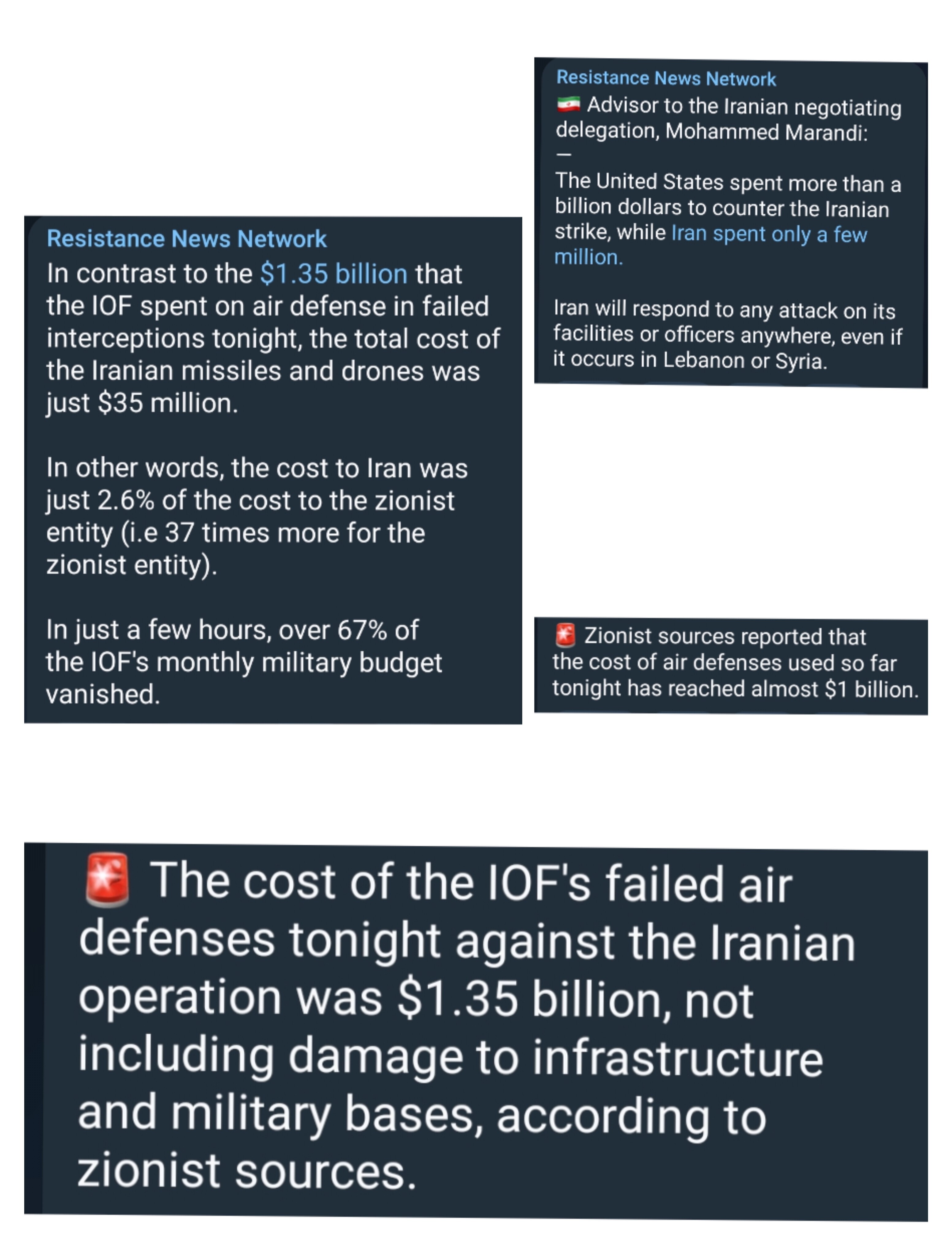
Apparently Iran spent 35 million yesterday while Israel spent 1.35 billion, not including all the support from US, UK, France, and Jordan ofc
Source is the Resistance News Network Telegram. Communists seem to widely it's a good source
Ofc, USD is somewhat infinite for the US but the important thing here is that Iran can produce these missiles and drones way faster than the West can produce the AA missiles
Those people are hopeless tbh
There's a reason why Temu is getting so popular and it's people who can't afford to be act all high and mighty realize it's all the same shit
Y'all are not gonna like this but I think it's in China's best interests to keep their allies like Russia and Iran fighting for as long as possible rather than joining and help win the war and they definitely recognize this. Non intervention has a big benefit of being to supply people with weapons and materials for a long amount of time. Essentially the same method that US took to become a superpower after WWII
Until their borders and sovereignty are threatened again like the Korean War, they'll never join any war in any real capacity other than trading more and making cash